BTW # 54 Back to the West Journey Tracks of the StoneBear
You never drink twice from the same stream.
Copyright MMXV ALL StoneBearTracks blog posts and photographs ALL Rights reserved
Monday August 13, 2012
10 miles west of Twin Lakes, Colorado
Independence Pass 12, 085' elev ON the Continental Divide
It took some doing to get here. On the road map it's Colo hwy 82 west from US hwy 24south -- south from Leadville, colo -- also see the Leadville, Colo posts.
Twin Lakes, Colo is a neat little historical sideout.... pop 100. The lodge has been here for 100 years... a couple blocks of dirt streets. on west 5+ miles is the Twin Peaks camp in the San Isabel national Forest.... a refreshing stop. -- see the Twin Peaks -- Perseides meteor shower post.
Head out on Colo hwy 82west. This road will take you to Aspen, Colo. I don't care to see Aspen. I've already seen Vail and Breckenridge, Colo and wanted to throw up after riding through town. Also wanted to take a shower after being violated to seeing these aborations -- tourist ski resorts among grand majestic mountains -- in the Rockies. Maybe it's better in the winter snow.
Heading west on Colo hwy 82, up this valley, 1,200' mountains on each side. Rock formations are amazing. Thick mountain forest terrain in this valley, wind over the mountain stream on the left,.... over a bridge and then the stream is on the right. This is the same Lake Creek I listened to last night 100' from the Twin peaks campsite. This is more than a creek... it's 100' wide most places with a lot of flow over mountain rock bed. The beds are rounded rock from the millenia of erosion. Absolutely beautiful stream flowing down. We're driving upstream -- up the valley.
Ascending on a steep pace. At times the road grade is 6% and little Hiddalgo II is going 15mph up the mountain road..
Running in and out of rain. Mountain fog. Up and into the fog clouds.... Visability in a mile ranges from 10 miles to 200 yards. Valley is amasing. Ascending up some shwitchbacks / hairpin curves.
come to a valley headwater. Winding creek through beaver dams. Mountains on every side.... up 2,000' verticle... Spectacular. Moist damp, wet road. Can see the road going up the mountain.
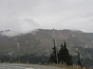
Drive on , ascending....stop at an overlook.... phenomenal view looking back down the valley. pix. Can now see the treeline on the mountains.... the point where forest evergreen pine trees grow.... and the line -- horizontal line on the mountains that are bare on the top.... just alpine tundra grass. No trees / vegitation will grow above a certain point on the mountain due to altitude ... harsh mountain wind erosion.
Switchback road up into the fog now. Visability 200' now... press on to the summit.
Independence Pass -- it IS the Continental Divide. 12, 095' elev. Fog / rain... viz 100' at times. Wind 25+
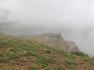
i've got to climb out onto this place. Driving rain.... sideways rain. ... stinging rain. Cold, 37*. Hike out to the actuall peak. Fog. I'm it! ; there is no one else here. ?Where is everybody? ?Why isn't there anyone else here? Pristene mountain peak. ... raw / sureal. Wind is 25+ gusts. A brief gap in the clouds & can see the actuall peak.
About 20 minutes to say a few prayers for Sons,... take in the stark, raw, cold element of this peak / pass. Evacuate and begin to head down.
Descending the peak, stop at an overlook... maybe a thousand feet below... maybey 11,000' now and the clouds / fog part for a few minutes. Can't take pix fast enough. Fantastic view of the mountain ridges and valley with the headwaters. Down from the Continental Divide... this was a phenomenal place to see.
You never drink twice from the same stream.
Copyright MMXV ALL StoneBearTracks blog posts and photographs ALL Rights reserved


