BTW # 32 - 81 Back to the West Journey
Monday July 22, 2012
Cache La Poudre scenic byway 1 , North Central Colorado Rocky Mountains
We've been in Ft Collins, COlo on the front range for too long; too much city/ too many people.... had to see about mechanical problems. A new 12volt battery and now ready to go. Too many people / cars on the front range... Let's make like a sheperd and get the flock out of here. Let's blow this Taco stand.
Head out on US Hwy 287N, then hwy 14west from Ft Collins... a COlo state scenic byway on the Cache La Poudre River valley -- Prounounced ... "Cash la poud- er". The French fur trappers stowed/ hid their gunpowder in this valley during a snow storm in the 1820's. The Poudre Canyon is beyond description for beauty ; it IS utterly stark and beautiful. This is one of the most scenic drives in America... I;m excited... let's get started. Got a box of Cheez-its... I;m ready to go.


Now ,... take into account... the 2012 forest fires in Colorado.... the national newscasts that Colorado was on fire... Colorado was burning.... was here. This canyon was on fire a month ago. It's out NOW. ... so let's drive this canyon up into Wyoming.
My plan on this road trip .. while Colo was burning... was to do a "6" . Come into Colo in the south... and curl up on the west side, and come across to RMNP from the West... the fires were out now.
Stop at Ted's Place, then stayed on hwy 14west, split at US 287 went to Laramie, WY; we'll get there the back way after driving the Cache La Poudre canyon.
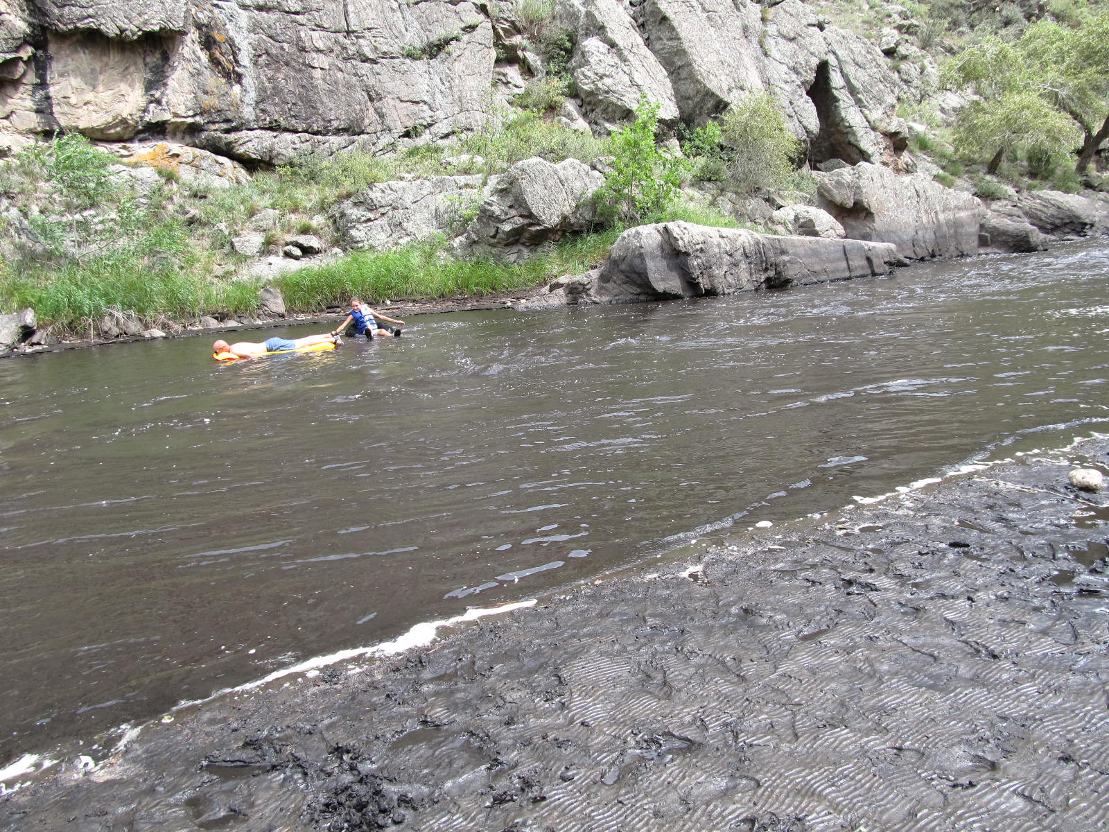
Up into the mountains immediatly... a couple of miles.... and have to stop at a river sideout / picnic area.
I've seen many things in my life... some pretty spectacular things and places.... but never have seen this. The Banks of the river were black. The river was black. Soot from the fires are still here. The river was BLACK ! You dip a glass and it looked like black coffee. The fires were here a week ago.


This bend in the river -- the river delta-- had steep sandstone canyon walls.... and a black river w/ black river banks.
Drive on and up into the canyon go through sections that were beautiful high plains sub- alpine forest... up 8,000' elev. Beautiful pines... some arid sections w/ sagebrush and high chapparell brush. Really beautiful,... following the Poudre river up the canyon. STEEP mountains/ mountain walls / cliffs in places. Magnificent!!!
Then come to a burned out section. uuuuuwww. Really black burned out mountain walls. Stubbs of brush about a foot tall, black,... brown dirt for a 6 foot radius and another burned bushroot 6" chared black stump. Wind has blown the black ash down into the canyon / river.
Driving this Canyon / river is amazingly beautiful in between areas of burned out desolation. A real contrast. Burned hills are still beautiful in their own way. A contrast that is sureal.... natural rockies forest... then burned hillsides 100 yards later....
Many hand painted signs on plywood, bedding sheets ect... offer a "Thank You firefighters" to show their thanks for saving homes, farms, ranches... and offer an earned respect for the firefighters that worked 16+ hour days for over a month. I saw only a couple of structures partially burned , or in ashes. With all this drought dried out fuel -- pines and brush -- so close to the houses in this canyon,... the wind in this canyon is 15+ on normal days. Reports during the fires were winds at 30+ making the fires racing rampant out of control. A LOT of homes/ families homesteads were saved; Thank you guys! Well done!
Driving through this Cache La Poudre river / canyon scenic byway is one of the most beautiful drives.... the burned out places -- sureal -- interesting to see a nature / fire zone aftermath. Makes you want to pay more attention to nature / soil conservation and definately heed those warnings about keeping campfires under control. Most campers do.
This was a great day. You never drink twice from the same stream.