Tracks of the StoneBear BNF = Banff, BC/ Alberta journey
ROF = Ring of Fire journey
British Columbia/ Alberta, Canada
Monday August 25, 2014 BNF 10
Jasper, AL 3
- Old Fort Point
... that's Jasper, ALBERTA... NOT Jasper, Alabama; Big difference.
Driving the Icefields Parkway the 1st time.... can't take pix fast enough... the Canadian Rockies... beyond description.
We stayed an extra couple days because Jasper was such a neat place.

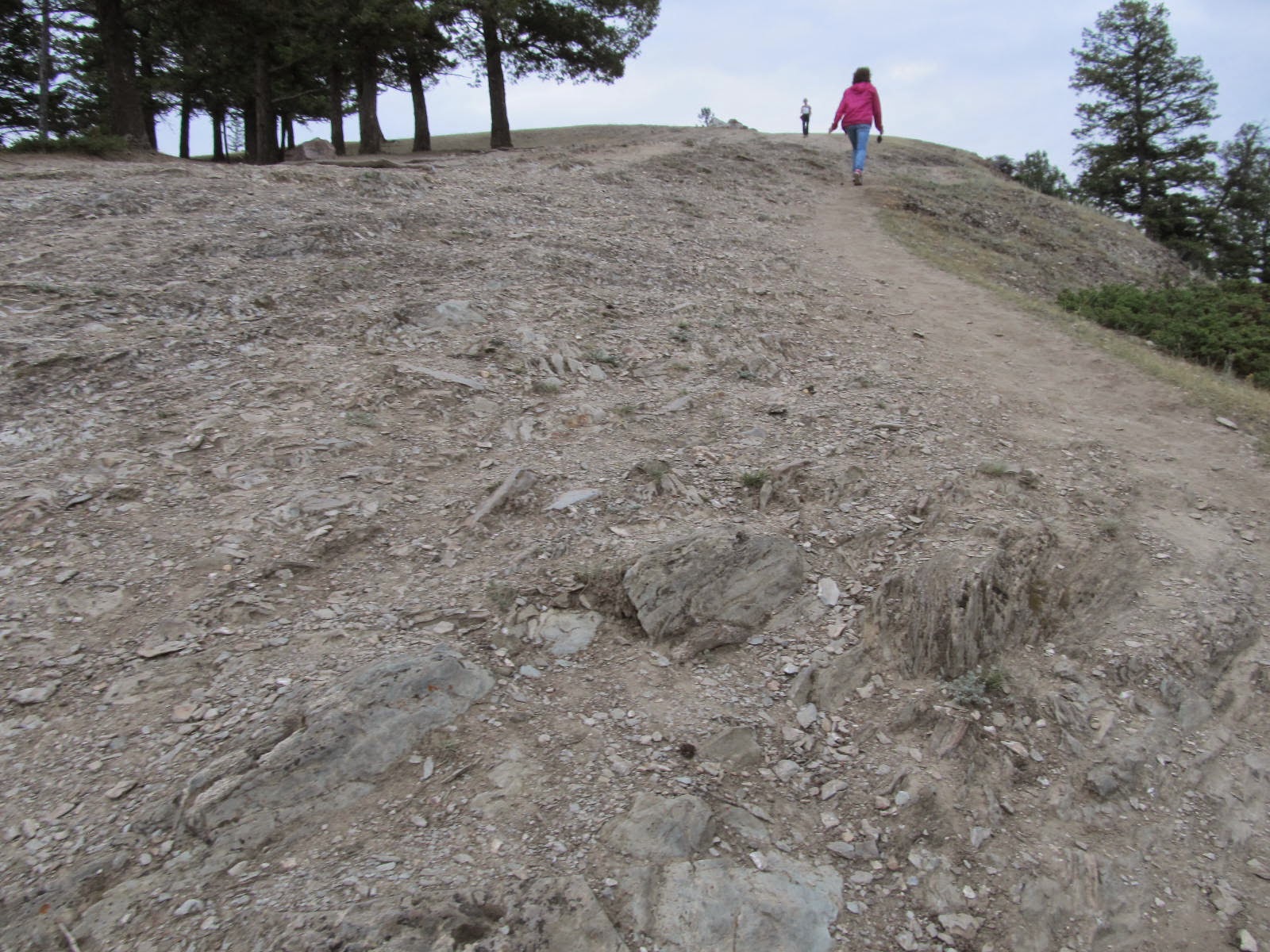
Late in the afternoon we went out to Old Forts Point, 3/4 mile straight up... like 3,000 stairs to a hilltop to overlook Jasper.


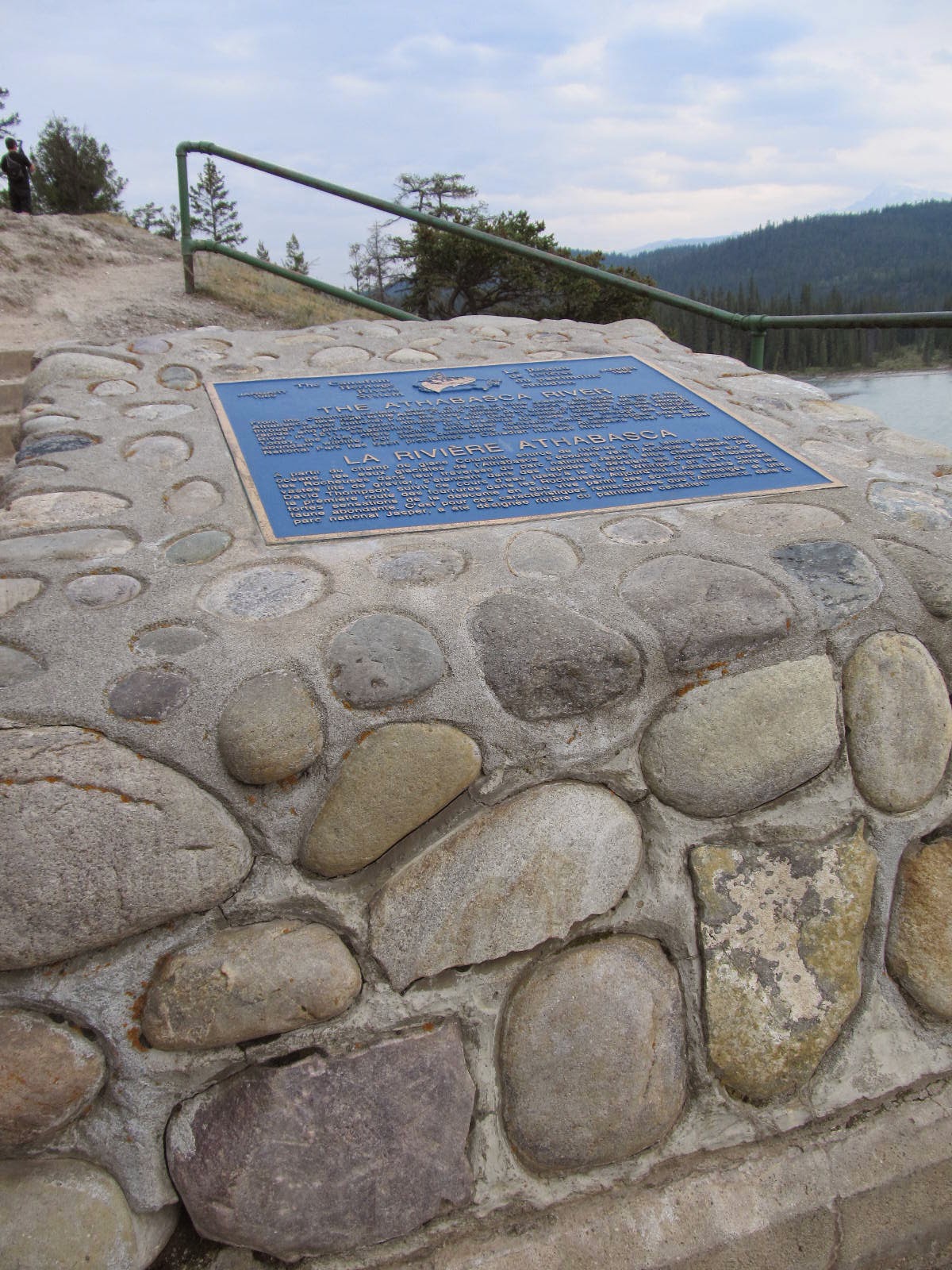
Just a couple miles from downtown and we go over the Athabasca River on a tough steel riveted bridge.

Dirt parking lot on the other side of the river. The river rafters get out here... a rafting bus for the ride back to Jasper.
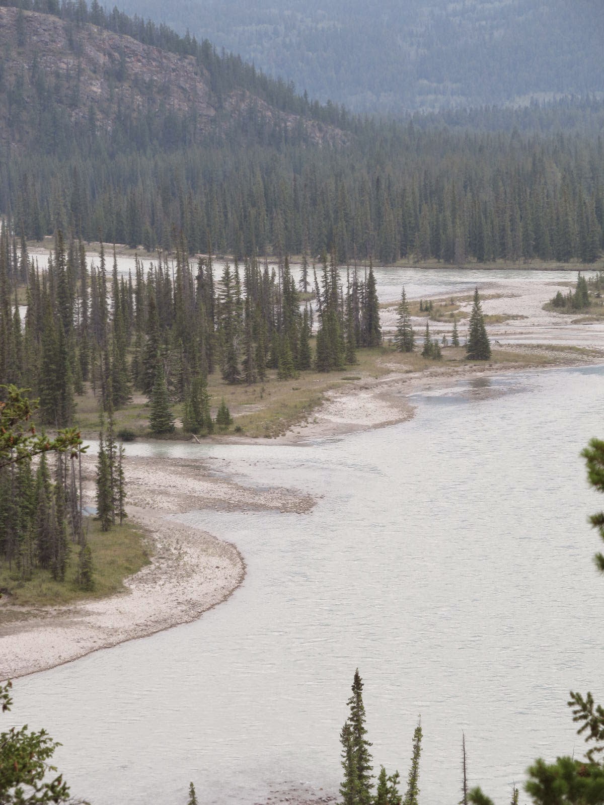
The river was moving fast. This is the Athabasca glacier runoff and this is a powerful river... 50 yards wide and moving fast... about 20+ mph. A LOT of water is moving.


We fish from the pedestrian walkway on the bridge for 30 minutes. Nada trout.


It's late in the day... 3pm+ and we start to hike the Old Fort Point trail . 3/4 mile straight up... like 3,000 stairs to a hilltop to overlook Jasper.


About every 200 steps have to stop and rest to catch my breath.

Getting some altitude now and begin to see the Athabasca river in a good view.

More sticks up; more rest stops. The view gets better every stop.

Come to a hiltop rounded meadow. View is getting real good now.


There's still another big push to the upper hilltop... not a hill, this is a mountain top as tired as I am.


The last push up the mountain... it's getting tough on me now. Rest stop and breath some every 100 feet now. I still have the heart of a 21 year old US Marine NCO... the body is worn out now at this age and it's all I can do.

The path winds around the back of the top. Huge rock formations... these mountains are sheer rock with a few inches of soil for ground cover... mostly tundra, there are trees around but mostly grass meadow.


the path is worn and narrow... to the right is a steep drop off so stay sure footed here.


Push on through to the top. Stop and rest. breathe.
Oh my god it was worth the hike!


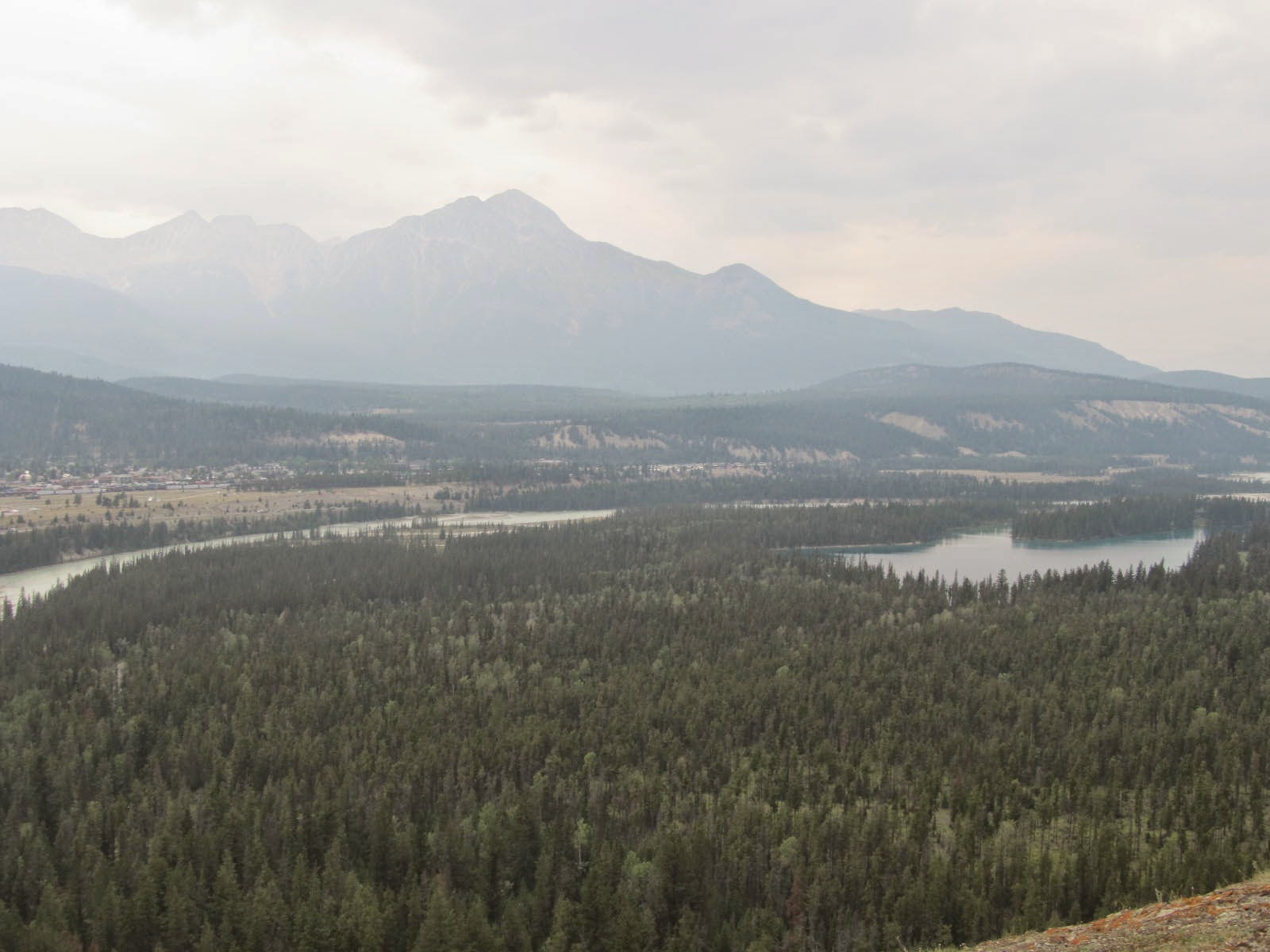


It's cloudy grey, somewhat overcast.... white mountain fog obscures the visibility. ... visibility is only about 10 miles but you can still see the snow cap mountain peaks surrounding Jasper and down the Icefields Parkway valley.


The view overlooking Jasper is magnificent. You see the town below... the railroad station. ... the Athabasca River winding underneath Jasper. You can see some of the rafters coming down the river.


WOW!!! That sums it up for man of few words.

Even in the cloudy grey of today,... it;s great. The pix of the days with the clear blue sky and visibility 40+ miles... that would be great. It's still great today with limited Visibility.
This was a 2+ hour hike... take the time... Jasper, Alberta is a phenomenal place to see. I recommend it highly!
You never drink twice from the same stream!
Take some water on your hike. A samich on top is even better.