ROF= Ring of fire Odyssey MEF-H = Marine Expeditionary Force- Hargus
MARNE journey = Canadian maritimes, NorthEast USA
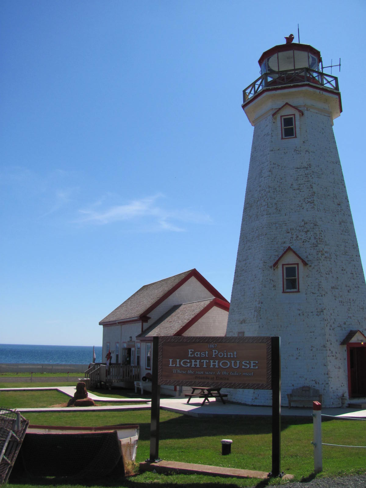
East Point, PEI 36 # 182
MARNE 36 # 182


MARNE 36 # 182
Monday July 25, 2011
East Point, PEI Prince Edward Island, Canada
Started out from Red Point this am. Strong black Marine Corps coffee and ready to go.
Taking a counter- clockwise route, I like these better when I have the option. Most traffic seems to run clockwise... so there's less traffic in front / of me - and behind - and I like that better. Also it's travelling with the Sun today. A short run north to see the lighthouse at East Point, then head west. Will cover some good daylight miles today. And it's a good view of the ocean.
Heading north, at Basin Head saw a Bald Eagle. WOW !
Then a short run north to East Point. This is THE most eastern point on PEI. This is the end of the line.
The sky is really blue. 60* and wind about 15 feels cool. Visability is at lease 50 miles as I can see Cape Breton Island to the East. Last week driving the Cabot Trail on Cape Breton.... could see the faint sighting of Land Ho to the west.. was PEI here at East Point. There were several seals off the point. The MV Madeliene is heading back to Souris. also see Souris post--
From here it's sail north around Cape Breton -- into the Cabot Straight -- Newfoundland to the north.... then it's the Atlantic / North Sea.
In the lighthouse building there was a map on the wall of all the shipwrecks of PEI. There were a LOT of ship sinkings marked going back centuries.
It's beautiful, peaceful, and quiet... serene.... now. Today. for the moment. Fog can form and move in quick. The seas can change quick. This lighthouse has served as a navigational point for 144 years in this strategic location. No telling how many sailors steered back home using this point. There are sure many that did not come back alive here where the tides rule life.
There are a lot of ships marked on that map. All over the maritimes, in all of these small towns are monuments/ memorials to the many sailors , fishermen, and travellers claimed by the sea.
The weather can turn quick up here. and often turns bad. Glad to see this today.
You never drink twice from the same stream.
StoneBearTracks Copyright Uncle Hargus MCMLXIII ALL blog posts/photographs/video ALL Rights reserved
ALL Blog posts/photographs/video Copyright MCMLXIII ALL Rights Reserved
Monday July 25, 2011
East Point, PEI Prince Edward Island, Canada
Started out from Red Point this am. Strong black Marine Corps coffee and ready to go.
Taking a counter- clockwise route, I like these better when I have the option. Most traffic seems to run clockwise... so there's less traffic in front / of me - and behind - and I like that better. Also it's travelling with the Sun today. A short run north to see the lighthouse at East Point, then head west. Will cover some good daylight miles today. And it's a good view of the ocean.
Heading north, at Basin Head saw a Bald Eagle. WOW !
Then a short run north to East Point. This is THE most eastern point on PEI. This is the end of the line.
The sky is really blue. 60* and wind about 15 feels cool. Visability is at lease 50 miles as I can see Cape Breton Island to the East. Last week driving the Cabot Trail on Cape Breton.... could see the faint sighting of Land Ho to the west.. was PEI here at East Point. There were several seals off the point. The MV Madeliene is heading back to Souris. also see Souris post--
From here it's sail north around Cape Breton -- into the Cabot Straight -- Newfoundland to the north.... then it's the Atlantic / North Sea.
In the lighthouse building there was a map on the wall of all the shipwrecks of PEI. There were a LOT of ship sinkings marked going back centuries.
It's beautiful, peaceful, and quiet... serene.... now. Today. for the moment. Fog can form and move in quick. The seas can change quick. This lighthouse has served as a navigational point for 144 years in this strategic location. No telling how many sailors steered back home using this point. There are sure many that did not come back alive here where the tides rule life.
There are a lot of ships marked on that map. All over the maritimes, in all of these small towns are monuments/ memorials to the many sailors , fishermen, and travellers claimed by the sea.
The weather can turn quick up here. and often turns bad. Glad to see this today.